Week 6 - INFOMAR and Mapping
During my 6th week on placement at the Marine Institute (MI), I had the unique opportunity to spend a day with the Advanced Seabed Mapping team within the Oceans, Climate and Information Services (OCIS) service area. This team conducts hydrographic and geophysical surveys for the INFOMAR (INtegrated mapping for the sustainable development of Ireland's Marine Resource) program, focusing on Exclusive Economic Zone (EEZ) mapping, marine habitat mapping, and resource mapping. The team is equipped with state-of-the-art tools and infrastructure and specializes in the acquisition, processing, and interpretation of large survey datasets.
The team relies on Global Mapper® which is a GIS software that provides a wide array of spatial data processing tools and supports various data formats. Its user-friendly interface allows for easy navigation and quick mastery, ensuring that even novice users can efficiently process data, create accurate maps, and manage spatial data. I was fortunate to be able to learn some of the functions of this tool and to work on cleaning up backscatter data from a 2019 survey during my time with the team.
Throughout the day, I also learned about the ambitious INFOMAR program, which aims to make Ireland the first country to have its entire seabed mapped by 2026. The program is jointly managed by the Marine Institute (MI) and Geological Survey of Ireland (GSI) and is funded by the Department of Communications, Energy and Natural Resources with an annual budget of €4 million.
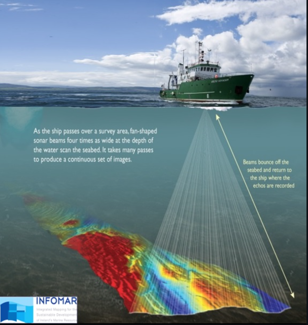
The Advanced Seabed Mapping team conducts multibeam surveys offshore and inshore, mapping both bathymetry (depth) and backscatter. (sound reflection that helps to determine substrate type). These surveys also involve the collection of core sediment samples and ROV/UWTV imaging, followed by Particle Size Analysis (PSA) and classification of samples for habitat and substrate mapping. This information contributes to the identification and preservation of Vulnerable Marine habitats, in line with ICES guidelines for deep-water ecology conservation and fisheries management.Regional Ocean Modeling System (ROMS) models, which use data on salinity, temperature, and current speed, are also employed for environmental analysis. The team uses bathymetry and environmental data from these surveys to create predictive models that help locate habitats and estimate species occurrence.
Spending a day with the Advanced Seabed Mapping team was an invaluable learning experience that provided me with insights into the importance of seabed mapping, environmental data analysis, and marine resource management. The team's dedication to the sustainable development of Ireland's marine resources serves as a strong reminder of the crucial role marine science plays in conserving our oceans and the diverse habitats and species that depend on them.
More information about OCIS and INFOMAR can be found here:
https://www.marine.ie/site-area/about-us/oceans-climate-and-information-services
https://www.infomar.ie/